A Playground Map Starts at the Gate
A photograph can show an accessible surface inside a playground. A visit also depends on getting to it, using it with other people and finding a way to rejoin the rest of the park.
In this story 5 sections
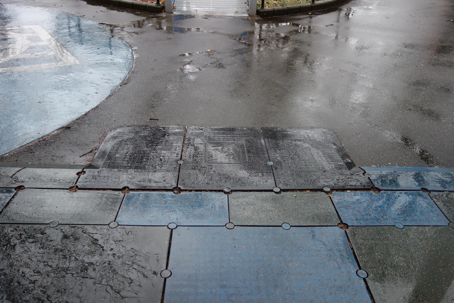
A ramp in the cover photograph joins two pieces of surface at a playground in Queens. The first surface belongs to a path someone can take through the park. The other belongs to an area made for playing. There may be plenty to remark on after a visitor has reached that area. The ramp stands out if you give your attention to the shorter question of getting from here to there. By following that question back far enough, you can learn quite a lot about why an appealing photo of equipment and an accurate map of real access serve different purposes.
New York City’s archive describes the early development of the Playground for All Children in Flushing Meadows–Corona Park, which opened in 1984. The city’s wider playground directory identifies characteristics such as wheelchair access, public restrooms and specific play features separately. Those distinctions are a useful way of structuring a visit even far from Queens. Getting inside, reaching an activity, joining in and having facilities the group can use may depend on different details. A single green pin on a city map does not explain all of them.
Draw a route from outside the fence
Start with a fictional playground with a fence, a gate and two paths on the outside. One path leads to a nearby sidewalk. The other approaches from a larger park space and goes past a public restroom. A parent arriving from the first direction may reach the gate sooner, while a person following a longer accessible route may take the other path. It is useful to record both. A doorway provided by a design does not help someone who cannot get to it along the route they assumed was available. In a larger park it can matter which street, stop or other landmark someone is being directed to in the first place.
At the gate, look for the next choice. Is the path into the play area obvious? Does another opening lead to the gate without making a visitor turn back through a group waiting to get out? A little area in which one person can wait for another can preserve space on the ordinary approach. Conversely a line of objects left at the entrance can make the usable space much smaller at the exact moment when more visitors are trying to get in. A path that appeared adequate in an empty-site drawing may therefore need another look once the place is in ordinary use.
Getting to a surface is different from having an entire suitable path across it. A ramp can get someone over one change of level, while another turn with a different material can produce a problem farther along. Make a note of where transitions occur, both in slope and in the surface itself. This can be done without deciding whether the place complies with a standard that needs professional evaluation. The simple report of a step, rough patch or gap at a named turn can be useful to a maintainer. Calling the entire site unsuitable may leave the main trouble harder to locate.
Put activity on the map as well as the route
If getting to the playground is the only line on the drawing, there will be no indication of what someone can do by taking it. Draw the locations of a few different activities. Which ones can people approach together? Which have room for a companion? Are there places where somebody can pause without being effectively removed from the whole play area? The best answer can depend on the families involved and what they need. The physical relationship is interesting before a designer has to decide how to measure participation.
Some activities create queues or require people to gather in a particular place. For example, the path to a play element can be suitably broad when it is empty and crossed repeatedly by waiting people when the place is popular. If you draw the line at the center of the path you may not account for the useful approach from the side. Put a couple of small shapes marking where people actually gather around each entrance. The shapes can show why two apparently independent parts of a site are hard to use at the same time.
A more useful set of observations can include sound, shade and rest. Different users may spend time in a quiet area or need a place from which they can clearly locate a familiar person. A shaded bench close to the play route can do something quite different from a shaded bench whose only approach lies outside the fence. An inventory of equipment should make it possible to ask whether these relationships are available. It should not have to claim that a single seat or sign can meet every need.
Let the people using a place change its description
A parks office may have good records of what was designed and installed. A person who visits several times may know what experiences changed on or after busy days. Both have useful kinds of information; they can differ without one being obviously wrong. Begin with questions about a specific route, condition or activity rather than asking whether someone has an entirely good or entirely bad opinion of the site. Listen for the place and time at which a difficulty arose. An observed barrier can become an actual part of a plan for improvement only if someone has been able to locate it.
For a small public review, ask about how people got to the gate, where a person first had difficulty and what they did next. Where appropriate use an anonymized sketch instead of identifying anyone. A person may have found another route but used considerable time to do so. Counting them as someone who successfully reached the area is a partial result. Another kind of note can show what had to change in the visit. The parks office can then distinguish a missing link from a link that works only when someone is able to take an unusually long detour.
Do not turn a single visit at an empty site into an assurance for every later visitor. Conditions can change during maintenance, heavy use or an ordinary period of wet weather. Staff and regular users may be able to explain where those changes occur most readily. These details are especially worth keeping in a record designed to be compared after a repair. Consider whether the fix made the intended route usable at the time when it mattered, rather than simply making one static sketch appear more coherent.
Follow a visit from the point of view of a group
A visit can involve more than one child and a companion. If the space offers a route that one child can take independently but the others have to go many yards around, the group will have choices to make before play starts. A seat that gives someone a good view of two areas can let people use them together. An inaccessible shortcut that appears inviting in a map can do the opposite. A drawing that follows each person in turn is a start. Where the routes overlap and where they split are facts about the visit that a list of equipment simply cannot register.
The pattern can change as people discover an available activity. Try drawing a loop from the gate to a play area, to a place to rest and back to another activity. Count the corners at which the group would need new information or a different surface. A useful notice might say that part of the circuit is unavailable and give a clear alternative, rather than silently depending on a change someone will encounter only after going halfway. This is information that can support many kinds of visit without presuming what everyone is going to do.
If an obstacle is reported, review it with respect to the loop, too. Removing a barrier at the beginning may give a group a route as far as the next one. On a follow-up visit, record where the changed approach now leads. The result that matters may only become clear several turns after the spot somebody repaired.
Give facilities their own locations and status
An accessible restroom can be an important part of staying long enough to use a park. The relevant questions include where it is, whether the path reaches it and its current availability. Even in a site that provides one, a specific visit could be affected by a closure or by access from a different side. NYC Parks’ directory is a reminder that an entry can keep restroom and playground characteristics distinct. A clear local map can carry that distinction to the visitor instead of using one general symbol to certify the entire trip.
Look once more at the small ramp in the photograph. It does a locally important thing. It connects a path and a piece of play space without requiring a visitor to cross the same change in level as a step. It is a particularly clear view of the sort of work that belongs on the map. Start earlier than that picture and continue slightly beyond it. The complete route can make several of those unremarkable connections in a row, offering room both to get to an activity and to choose something else afterward.